Original source: Eze Martínez
This video from Eze Martínez covered a lot of ground. Streamed.News selected 7 key moments and summarises them here. Everything below links directly to the timestamp in the original video.
Flat maps deceive us. Next time you see a flight path, notice its strange curve; it proves the shortest route on a sphere is rarely a straight line.
Shortest city routes aren't straight lines on maps
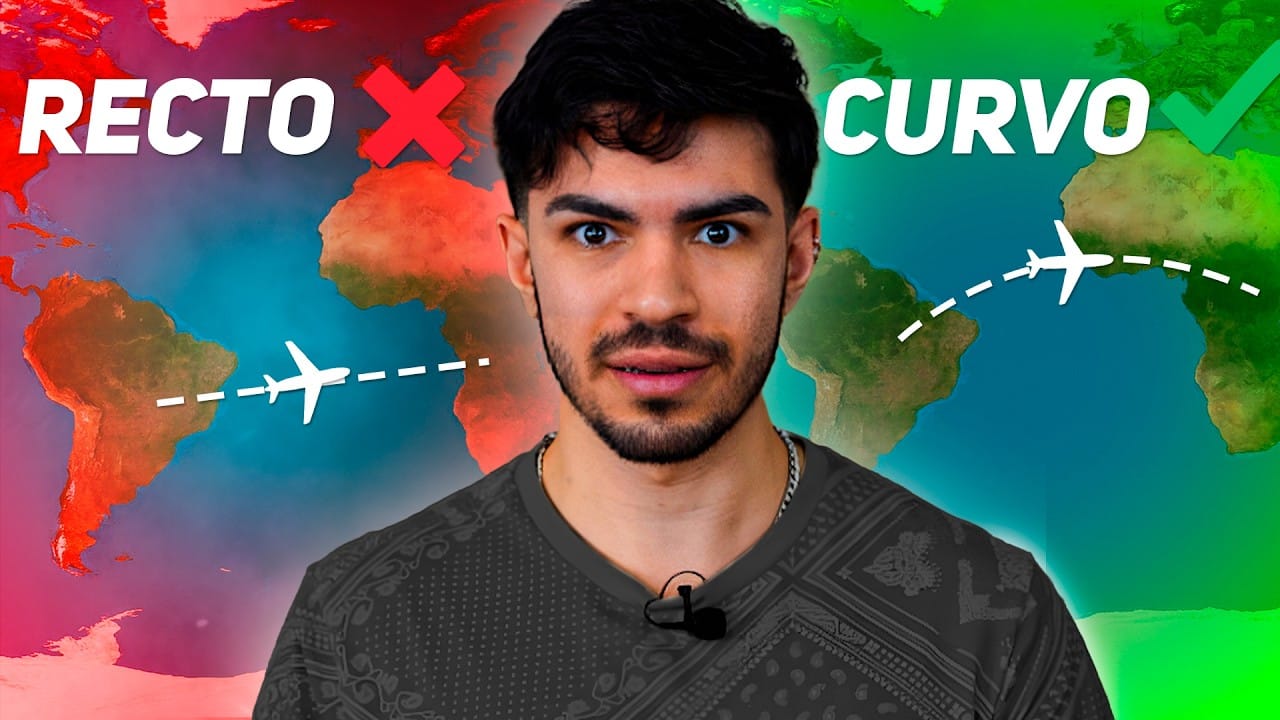
The shortest path between two Earth points, like London and San Francisco, isn't a straight line on a conventional map. This "great-circle route" or "orthodromic distance" is a curve following the planet's surface. A transatlantic flight, for instance, often passes over Greenland, proving significantly shorter and saving fuel.
This phenomenon shows flat representations of a spherical world inherently mislead large-scale navigation. Calculating these efficient routes isn't trivial; it demands spherical trigonometry, a complex mathematical discipline for navigation.
"On a perfect sphere, any great-circle route is a segment of a circle passing through the sphere's center."
Map created where straight lines represent Earth's shortest routes
A cartographic projection solves the problem of curved routes on flat maps: the gnomonic projection. While this map completely distorts continents' shapes and sizes, it has a unique feature: any straight line drawn on it matches the shortest path on Earth's surface.
These shortest paths on a surface are geometrically known as "geodesic lines." The gnomonic projection thus becomes a fundamental tool for navigation and global route planning, intuitively visualizing the most efficient trajectories.
"It's a completely distorted map, but uniquely, any straight line drawn on it perfectly matches the shortest route on Earth's surface."
Why Greenland appears Africa-sized on Google Maps
The Mercator projection, used by services like Google Maps, preserves local angles and country shapes—a "conformal transformation." However, this advantage brings a huge drawback: massive area distortion, especially near the poles. This makes Greenland appear as large as Africa, when Africa is actually over seven times bigger.
Creating a flat map that faithfully retains both areas and shapes simultaneously is mathematically impossible, forcing cartographers to choose which geometric property to sacrifice.
"No map can be conformal and preserve areas simultaneously. If a map is conformal, like Mercator, it cannot preserve areas."
Map Orientation Creates Global Psychological Bias
The convention of north-up maps is an arbitrary decision with deep psychological consequences. Popularized by Gerardus Mercator's 1569 map during European exploration, this norm established a "north-south bias" in collective perception. This bias associates the north with higher status and wealth, and the south with its opposite. This pattern appears locally, in wealth distribution in cities like Buenos Aires, and globally, where most developed economies are in the Northern Hemisphere.
"The psychological effect was that people started associating the north with richer, higher-status people and higher prices. The south became associated with poorer, lower-status people and cheaper prices."
Mercator Map Feature Revolutionized Ancient Navigation
Mercator projection's dominance in navigation history stems from a unique property: the ability to plot "rhumb lines." A straight line on this map represents a constant compass bearing, crossing all meridians at the same angle. This feature radically simplified transoceanic voyages for ancient mariners; they only needed to set a compass direction and maintain it. However, this simple navigation route does not represent the shortest path between two points on the planet's surface.
"It was very useful in ancient times, mostly for traveling long distances by ship because you'd set a direction on the compass and just go straight, reaching your destination."
Gravity May Be the Shortest Path in Reality's Curvature
The concept of "geodesic lines"—the shortest path across a curved surface—offers a powerful analogy for gravity. Just as two travelers on parallel paths on Earth eventually meet due to the planet's curvature, objects in the universe follow paths determined by spacetime geometry. According to Einstein's general relativity, what we perceive as gravity isn't an attraction; it's objects moving along these geodesics. An object doesn't "fall"; it follows the shortest possible route through a reality curved by mass and energy.
"An object doesn't fall as such; it's following the shortest path in the curvature of our reality."
North wasn't always up: how ancient maps were oriented
Ancient maps rarely placed north at the top. For centuries, influential works like the 1154 Tabula Rogeriana put south up. East was often the primary cardinal point, a preference that coined 'orientation' and shaped 'T-O maps' with Asia on top. Northern cultures linked north with darkness, seldom giving it cartographic prominence.
"Throughout history, finding north at the top of maps was very rare. Most common, strange as it sounds, was placing south and east at the top."
Also mentioned in this video
- London to San Francisco flight illustration (0:02)
- Challenge of mapping Earth's curved surface (1:26)
- Introduction to map projections (cylindrical, etc.) (2:16)
- Discussion on map center position (e.g., prime meridian) (7:04)
- Revisiting why planes don't fly in straight lines (7:54)
Summarised from Eze Martínez · 16:16. All credit belongs to the original creators. Streamed.News summarises publicly available video content.